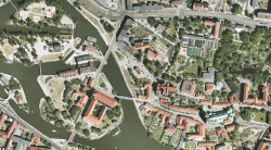
ORTHOIMAGERY
Tools
Slider makes it possible to seamlessly switch between different editions of our orthoimagery.

Orthoimagery editions
2024 edition
The photographs were taken on April 26th and 27th 2024 with resolution of 5 cm per pixel.
The data was obtained from GUGiK.
This data is also available as a WMS service and WMTS service
2023 edition
The photographs were taken on June 3rd 2023 with resolution of 25 cm per pixel.
The data was obtained from GUGiK.
This data is also available as a WMS service and WMTS service
2022 edition
The photographs were taken on May 24th 2022 with resolution of 5 cm per pixel.
The data was obtained from GUGiK.
This data is also available as a WMS service and WMTS service
2021 edition
The photographs were taken on May 10th 2021 with resolution of 5 cm per pixel.
The data was obtained from GUGiK.
This data is also available as a WMS service and WMTS service
2020 edition
The photographs were taken in the 2nd-3rd quarter of 2020 with resolution of 25 cm per pixel.
The data was obtained from GUGiK.
This data is also available as a WMS service and WMTS service
2019 edition
The photographs were taken on April 16th 2019 (south of the city) and on June 27th 2019 (north of the city) with resolution of 25 cm per pixel.
The data was obtained from GUGiK.
Current 2018 edition
The mosaic covers entire city limits. Unlike older editions it does not exclude any classified areas.
The photographs were taken on April 6th and 7th 2018 with resolution of 4 cm per pixel.
Read Orthoimagery 2018 terms of use.
This data is also available as a WMS service and WMTS service
2017 edition (for a fragment of the city)
The mosaic covers southern and eastern parts of the city and part of its surroundings.
Orthoimagery RGB made by MGGP Aero Sp. z o.o. Photographs were taken in 2017 with 10 cm per pixel resolution. Measurement accuracy of this edition is marked as 30cm.
The data was obtained from GUGiK.
2015 edition
The mosaic covers entire city limits. Unlike older editions it does not exclude any classified areas.
The photographs were taken on June 5th and 6th 2015 with resolution of 5 cm per pixel.
Read Orthoimagery 2015 terms of use.
This data is also available as a WMS service
2015 edition (for a fragment of the city)
The mosaic covers northern and central parts of the city and part of its surroundings.
Orthoimagery RGB made for the LPIS project, by OPEGIEKA Elbląg. Photographs were taken in 2015 with 50 cm per pixel resolution.
The data was obtained from GUGiK.
2014 edition
The mosaic covers entire city limits.
Photographs were taken on March 12th and 20th 2014 with 10 cm per pixel resolution.
The data was obtained from GUGiK.
2012 edition
The mosaic covers entire city limits.
With accordance to laws of the time, classified areas were blurred.
Photographs were taken as a part of government ISOK programme in April 2012 with 10 cm per pixel resolution.
2011 edition
The mosaic covers entire city limits.
With accordance to laws of the time, classified areas were blurred.
Photographs were taken in October 1 and 2, 2011 with 10 cm per pixel resolution. Measurement accuracy of this edition is marked as 50cm.
2009 edition
The mosaic covers entire city limits and significant part of its surroundings.
With accordance to laws of the time, classified areas were excluded.
Photographs were taken in April 2009 with 10 cm per pixel resolution. Measurement accuracy of this edition is marked as 50cm.
2007 satellite edition
The mosaic does not cover western and southern parts of the city.
With accordance to laws of the time, classified areas were excluded.
Photographs were taken by a satellite on September 24 2007 with 80 cm per pixel resolution.
2006 edition
It was one of the first such project in the country, providing municipality with imagery of unmatched quality at the time.
Photographs were taken on May 4 through May 6 2006 with 10 cm per pixel resolution. Measurement accuracy of this edition is marked as 10cm.
1994 analogue edition
Photographs were taken by an analogue camera and digitally scanned.
2015 edition terms of use.
Users have a right to:
- view the data through our mapping application http://gis.um.wroc.pl/imap/ and WMS service witout any use restrictions (personal, educational and commercial use)
- copy and distribute the data for personal use
- print and distribute in printed form fragments of data without restrictions
-
distribute in digital form for personal, educational and commercial use under following restrictions:
- without georeferencing data
- in resolution not bigger that 1920x1080 pixels
- data is not to be presented in a form of interactive maps
- modify, transform and distribute the derivative works without restrictions
An following atrribution note is welcome in case of distributing the imagery: „Source: Wroclaw Spatial Information System - www.geoportal.wroclaw.pl”.
License proprietor of 2015 Orthoimegery is the Municipality of Wrocław.


