MUNICIPAL TECHNOLOGY CHANNELS
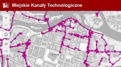
The map presents the location of the Municipal Technological Canals (MKT) in Wroclaw. It is a visualization of data prepared by the Zarząd Dróg i Utrzymania Miasta in Wroclaw.
Map content
Last data update: 19.01.2026
The map presents the location of the Municipal Technological Canals (MKT) in Wroclaw. It is a visualization of data prepared by the Zarząd Dróg i Utrzymania Miasta in Wroclaw.
Last data update: 19.01.2026


