- Strona główna
- Basemap
- Local plans
- Plan ogólny miasta Wrocławia - opiniowanie i uzgadnianie
- Study 2018
- Previous Spatial Development Study
- Access to transportation infrastructure
- Property map
- Real Estate Exchange
- Decisions of Wrocław Architecture Division
- Orthoimagery
- OBLIVIEW – oblique imagery and 3D data viewer
- Demography
- Osiedla kompletne
- Osiedla Wrocławia
- Education
- Municipal Register of Monuments
- Degraded and revitalized area
- Environment
- Decision on environmental conditions
- Sprawy WSR dot. usuwania drzew i krzewów
- Map of the Wrocław Municipal Greenery Authority
- Solar potential map
- Documented geological drilling
- Adaptation to climate change
- Hypsometry
- Elevation Profiles
- 3D city model
- 2022 Strategic noise map
- Bicycle map
- Truck traffic
- Transportation
- Paid parking zones
- Electromobility
- Road accidents and collisions
- Municipal investments
- Restriction on the sale of alcohol
- Municipal Technology Channels
- MPWiK map
- Help
- Planowanie przestrzenne
- Plany miejscowe
- Plan ogólny
- Spatial Development Study
- Decyzje lokalizacyjne
- Specustawa mieszkaniowa
- Wykaz z rejestru wniosków
- Partycypacja w planowaniu
- Statistics
- Wzory dokumentów
- Streets and addresses
- Datasets, services and tools
- About us
- O Wydziale Planowania Przestrzennego
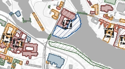
MUNICIPAL REGISTER OF MONUMENTS
About the map
The map presents information on buildings, areas and other property listed in Municial Register of Monuments.
Additional information on every item including its photograph is available upon its identification.


